Speaker Bio & Abstract

|
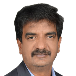
Dr. Pradeep Kishore
GISCOE Infosys BPM Abstract Mapping innovations for Smart Urban DevelopmentThe advent of smart city initiative by government of India to furnish economic growth across the country and with the objective of enhancing the living standards of people, further city planners are edging towards digital technology & advocating mapping mechanisms as a means to generate smart & sustainable environment for citizens. Increase in population and rapid urbanization has led to congested transport, unplanned settlements, rampant pollution & environment degradation, strain on limited resources, and sanitation hazards. The mapping technologies related to location intelligence provides enough testimony to plan, develop, and manage the city administration to maintain city governance run effectively. Maps were and are answerable to various questions that evolve from city governance and related policy making. Real-time information been the cutting edge technology of the present world provides valuable inputs to key stakeholders for instant decision-making. In almost all of the areas of city administration viz. traffic, public utilities, health, infrastructure, communities, people, geospatial technology, and its related components together provide an important decisive role. |