Speakers
Chief Guest
Chief Guest
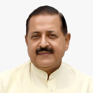
Hon'ble Shri Jitendra Singh
Union Minister of State (Independent Charge) for Science & Technology, MoS PMO, Personnel, Public Grievances, Pensions, Atomic Energy, and Space
Plenary
Lt Gen. Anil Bhatt (Retired)
Director General
Indian Space Association (ISpA)
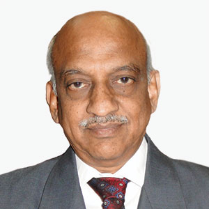
AS Kiran Kumar
Member
Space Commission
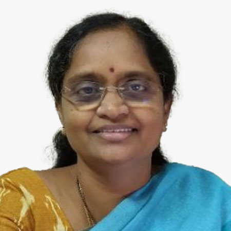
Rama Devi Lanka
Director-Emerging Technologies | Officer on Special Duty (OSD)
ITE&C Department, Government of Telangana
Agendra Kumar
Managing Director
Esri India
Rajan Aiyer
Managing Director
Trimble India
Anoop Singh
Director General
Forest Survey of India
Alok Prem Nagar
Joint Secretary
Ministry of Panchayati Raj
G Asok Kumar
Director General
NMCG
G. Asok Kumar is currently working as Special Secretary and Director General of the National Mission for Clean Ganga, in the Ministry of Jal Shakti, Government of India. During his tenure, Namami- Gange the flagship program of Government of India to clean and rejuvenate River Ganga and its tributaries was recognised as one of the top 10 "Eco-Restoration World Flagships" by UN (by a UNEP- FAO led consortium) at the Bio-Diversity CoP15 (Conference of Parties) on 13 December, 2022 at Montreal Canada. During his tenure many innovative people centric programs were launched under the "Arth Ganga"; a concept suggested by Hon'ble Prime Minister in the National Ganga Council meeting in 2019 at Kanpur. These include identification of the 6 pillars of Arth Ganga- (viz Natural Farming; Monetization and Reuse of Treated Water and Sludge; Generation of Livelihood opportunities; Promotion of Tourism and Cultural heritage; People's participation; and building of institutions and capacities of stakeholders); starting of the DGC forum meetings (District Ganga Committee- 4M- Monthly, Mandated, Minuted and Monitored) meetings; Promotion of River Cities Alliances, Ghat par Yoga, Ganga Artis, staring of PRAYAG- Platform for Realtime Monitoring of Yamuna And Ganga and tributaries etc. These are in addition to the multifold increase in the Sewage treatment Capacity created - about 2000 Million Liters Daily (MLD) in 2 years from Jan 2022 to October 2023 compared to 998 Million Liters Daily (MLD) in 8 years from 2014- 2021.

Motoyuki Arai
CEO
Synspective

Maj Gen (Retd.) Clint Crosier
Director
AWS for Aerospace & Satellite

Kai Umino
President
Topcon Asia
Ramya Mohan
Chief Strategy Officer
Cyient
Sanjay Kumar
Founder and CEO
Geospatial World
Rakshit Bhatt
Co-Founder and VP of Product Development
GalaxEye
Sreeramam G V
CEO
NeoGeoinfo Technologies Pvt. Ltd
Vishal Dhupar
Managing Director - India
NVIDIA

Abhilasha Purwar
CEO
BlueSky Analytics

Kranthi Chand
Head - Strategy & Special Projects
Dhruva Space

Dr P. Veeramuthuvel
Project Director
Chandrayaan-3

Kaushik Chakraborty
Senior VP, APAC
Bentley Systems

Prateep Basu
CEO
Satsure

Amal Jaiswal
Head - Digital Enterprise Business
Siemens
SP Agarwal
Director
North Eastern Space Applications Centre

Kundu Biswaketan
Vice President
Reliance Jio Platform
Saurabh Rai
CEO
Arahas Technologies
Deven Laheru
CEO
ScanPoint Technologies
Sudheer Singh
Director, Outreach and Capacity Development
ISRO
Dr Mahaveer Singhvi, IFS
Joint Secretary
Ministry of External Affairs
M Nagaraju, IAS
Addl. Secreray
Ministry of Coal
M Raghunandan Rao, IAS, APC
Secretary to Govt., Agriculture Cooperation Dept.
Govt. of Telangana
Neel Mehta
Co-Founder
Asteria Aerospace Ltd
Neel Mehta is the Co-founder of Asteria Aerospace Limited, a full-stack drone technology company, providing actionable intelligence from aerial data. At Asteria, Neel is leading company's product development, R&D, and engineering since its inception and working towards expanding the use of drones across multiple industry sectors. Neel has been focusing on the development of innovative, reliable, and performance-driven drone solutions for government and industrial applications by combining the latest in aerospace, robotics, cloud, and artificial intelligence technologies.
Before venturing Asteria Aerospace, Neel has worked with Rockwell Collins Inc. in the U.S. and was involved in the design and development of flight control systems for commercial aircraft. Prior to that, Neel also worked as a Graduate Teaching Assistant at Georgia Institute of Technology and as a Graduate Technical Intern at Rockwell Collins. He also had the privilege of associating with the Indian Space Research Organization (ISRO) as an Engineering Intern while he was pursuing his Bachelor's degree in Aerospace Engineering at Purdue University. Neel also holds a Master's degree in Aerospace Engineering from Georgia Institute of Technology.
Environment and Climate Change
Dr P.V. Chalapathi Rao
Special Secretary
Environment, Forest, Science and Technology, Government of Andhra Pradesh
Rajashree Bothale
Deputy Director
NRSC
Shantanu Sharma
Founder and Head
Pro Zero Carbon
Charu Dhyani
Founder & Chief Creative
Wudbox

Ramya Ragupathy
Senior Product Owner
Humanitarian OpenStreetMap Team

Abhinandan Arya
VP, Head of Technology Solutions
Synspective
Dynamic and innovative Technology executive with expertise in remote sensing and computational intelligence, Mr. Abhinandan is an AI professional with industry experience in telecommunication, satellite remote sensing, and product design & development. Graduated from India's Ivy League, Indian Institute of Technology (IIT), Guwahati in Electronics and Electrical with Computer Science and Engineering, He has worked in Research and Development with leading universities and MNCs in India, South Korea, and Japan.
Mr. Abhinandan has demonstrated research, and professional excellence throughout his career working with large corporations, like Vodafone Group, Tech Mahindra as an Engineering Leader, and Technology Specialist. He also holds a PGP degree in Artificial Intelligence and Machine Learning: Business Applications from the University of Texas at Austin.
Currently, Mr. Abhinandan is the Head of Technology for Solutions at Synspective and is leading the core solution research and development using our SAR satellite constellations.

Jitendra Kumar Sahoo
Senior Manager
PCI Software Pvt. Ltd.
Mr. Jitendra Kumar Sahoo is currently the Senior Manager at PCI (PCI Software Pvt. Ltd.). Jitendra has over 15 years of experience in the geospatial industry. In this role, jitendra provides technical expertise and business case analysis for PCI. Jitendra works directly with users to enhance the capabilities in software for efficient imagery and point cloud data processing. He also works with customers to optimize and scale their data processing workflows. His primary interest is achieving the highest-accuracy results from aerial imagery and point cloud data using innovative technology.
Ashish Tiwari*
Secretary, Department of Environment
Forest & Climate Change at Government of Uttar Pradesh
Prateek Sharma
Vice Chancellor in - charge
Teri SAS

Dr Shikha Anand
Senior Program Associate
WRI
Dr. Shikha Anand is working as Senior Program Associate in the Energy Access Team at WRI India where she supports the strengthening of data-driven integrated energy planning for equitable energy access across several Indian geographies.
She has diverse experience ranging from application of remote sensing and GIS techniques to providing directional and policy inputs on topics related to climate change, nature-based solutions & ecosystem services, just-transition, blue economy, carbon market in India, etc.
She has previously worked at the Natural Resources and Environment Vertical, NITI Aayog and Rural Development and Watershed Monitoring Division, National Remote Sensing Centre.
Swayam Mallik, IFS
Dy Project Director
Odisha Forestry Sector Development Society (OFSDS)
Dr Pratap Singh
VP, Sustainability
RMSI

Dr Nagaratna Kopparthi
Scientist(E)
IMD
Dr K. H. V. Durga Rao
Group Director
Disaster Management Support Group National Remote Sensing Centre (NRSC), ISRO
L. Mohamed Mansoor
Additional Secretary to Government of Puducherry
Pratul Shrivastava
Deputy General Manager
Sustainability (Risk & Insurance), RMSI
Sarwan Bhati
Lead Strategic BD - Rural & Geospatial Business
AWS
Dr Palash Sinha
Project Manager
C-DAC
D. Ranga Reddy
Chief Engineer
CWC

Myles LaBonte
Channel Business Development
Blue Marble Geographics
Agriculture and Irrigation

Dr Suresh Kumar Mojjada
CTO, Mariculture
ICAR Marine Fisheries Research
Pramod Kumar Parida
Senior Scientist
ORSAC
Sushant B Patnaik
Associate Director - Business Planning & Development
DHAVALAS
Sushant B Patnaik has 25+ years of experience in technology project management, sales, and marketing. He had done Mechanical Engineering, MBA in Marketing and Operations from IIBM Indian Institute of Business Management, and also, he did MSc in Marketing from National College of Ireland, Dublin.
Sushant started his career with Cyient Technologies Limited in the year 2000 as a CAD Engineer then he worked with RMSI Pvt Limited, Rolta Limited. His expertise is in project management, business operations management, and Marketing. He worked in areas of Location Based Services (LBS), Utility Mapping, Land Record Management, Weather Applications, and Precision Farming. He worked on multiple GIS technologies, AI, and ML Technologies. He bagged multiple projects and worked on various Govt, multilateral funded, and private company projects.
He is an entrepreneur by nature, he started two companies in the space of enterprise application, and export of agri products. Currently, he is working with the Dhavalas Group of Companies as an Associate Director and Group Vertical Head of Business Planning Development (BPD).

Sourabh Bagla
Senior, Vice President
Absolute - Upaj
Dr Bharath Setturu
Post-Doctoral Fellow, EWRG, CES
IISc (Indian Institute of Science)
Vishala Reddy Vuyyala
Founder
Milletbank
Kavita Salvi
Project Development Manager
RegalarTech Private Limited

Dr Brijendra Pateriya
Director
Punjab Remote Sensing Centre (PRSC)
Dr. Brijendra Pateriya, is holding the position of the Director of Punjab Remote Sensing
Centre (PRSC), Ludhiana since 2011. He is a multidisciplinary expert with key
interests in applied research in natural sciences, Geospatial & ITES technological
applications for a wide range of user communities. A versatile and seasoned
professional having over three decades of professional experience, possessing a rich
and unique combination of academia, industry and senior government administrative
cum management skills.
Dr. Pateriya has been conferred with "National Geospatial Award for Excellence" by
Indian Society of Remote Sensing, "India Geospatial Excellence" Award by GeoSpatial
World Media & Communication. He has been awarded ISCA, "Certificate of Merit"
under Young Scientist program. Under his leadership PRSC has receives many
accolades at international and national level. He is serving Chair/members of various
national and state level committees and boards constituted by government in different
ministries and organizations. He is an expert member of technical committees of
academic institutions and supervising PhD scholars of IITs and Universities in area of
Geospatial and Natural Sciences. Dr. Pateriya has about two hundred research papers
published in international and national peer reviewed journals and conferences. He
has provided leadership and managed several international, national and state level
mission projects of multilateral funding agencies such as The World Bank, Asian
Development Bank, JICA, UNDP, USDA, FAO, Australian Consulate in addition to
assignments of Navratna organizations, ISRO, DST, ministries of Agriculture, Housing
and Urban Development, Local Government Bodies, Environments & Forest, Water
Resources of Govt of India and state governments and other leading industries of the
country and abroad. Currently contributing significantly on national mission
progammes of Digital Agriculture in collaboration with Govt. of India and Govt. of
Punjab such as National e-Governance Program in Agriculture (NeGP-A) and
Agristack besides others applications under Geospatial domains including Agriculture
and Irrigation sectors..
Kapil Chawla
Founder & Director
Innomick Technologies

Dr Shyju Krishnan
Esri India

Siddhartha Khare
Dept. of Civil Engineering
IIT Roorkee, Uttarakhand, India
B Sivaram Prasad
Vice President
TriCAD
B. Sivaram Prasad is a seasoned professional with a BTech from the University College of Technology, Osmania University, and an MBA in Systems from Calcutta University. With over 23 years of experience in the IT and Geospatial industry, he has left an indelible mark in his career. He has held key positions with renowned companies such as TriCAD, Hexagon, ESRI, Wipro, and HCL.
Throughout his career, Sivaram has been a driving force behind major projects focused on enterprise GIS solutions for climate-resilient agriculture & Disaster Management . Currently, he's dedicated to helping customers leverage the potential of deep learning technologies, using Trimble Geospatial Platform. His unwavering passion lies in exploring technology applications for the betterment of agriculture, Natural resources.

Dr Harish Balduri
Research Scholar
Osmania University

Ananya Narain
VP-Commercial Consulting
Geospatial World
Krupalini Venkataswamy
Head - Data Acquisition
Agribridge India LLP
Vijay Nadiminti
Chief Executive Officer
AgHub
Dr V. Praveen Rao
Vice Chancellor
Kaveri Agricultural University & Former VC, PJTSAU, Hyderabad, Telangana
V. Ram Kaundinya
Managing Director
Advanta Ltd.
Susanth Masana
Founder & CEO
Farm Sathi
Dr Kuppusamy
Head- Regulatory Affairs & Product Development
NACL
Vinod Kumar Samanthula
Founder & Director
Senseacre Labs Pvt.Ltd
Vinod is a highly regarded leader with demonstrated experience in managing businesses, helping global organizations in establishing and expanding their business operations in India.
Vinod is a Mechanical Engineer and Alumni of IIT Madras and IIM Bangalore.
He did executive education programs in leadership decision making, e-governance, Investment decisions and behavioural finance from John F Kennedy school of government at Harvard.
Extensive Technology orientation in ERP (SAP & Oracle), FSRU, Desalination, Power Storage, UAVs, Smart Cities from IDE, GOLAR, SAMSUNG, Advancion, Sensefly etc.
Worked one on one with Global Leaders and Management Gurus like CK Prahalad, MK Raju, John Caslione and Dr APJ Abdul Kalam.
Vinod had the privilege of working as partner in PSLV, GSLV Satellite missions and Brahmos, Aakash and Prithvi Missile programs with ISRO and DRDO across India.
His specialization and sector experience ranges from IT, Water, Monorail, Satellite Communications, Agriculture, Healthcare to Energy and Infrastructure. He is also an expert in mapping technology to business integration.
His Engineering and Information Technology expertise spread over 25 years with NEPC MICON Ltd, Thermax Limited, Siemens Information Systems Limited, Intelligroup Inc, The Boston Group, YASH Technologies Inc and finally as CEO at Ananth Technologies Ltd. He has many firsts to his credit in bringing the best for India.
Arvind Modi
General Partner
Sathguru Catalysers
Arvind Modi is a senior Private Equity and Venture Capital Fund manager. Over the past 17 years, he has managed 6 venture capital funds with assets under management of over $ 500mn. He is among the few investors having a successful track record of investments and profitable exits. His areas of interests include healthcare, agriculture, food, consumer, climate and related technologies.
He is on the Board of various companies. He is also an active angel investor and start-up mentor with various incubation centers like NAARM aIdea, IIT-Mumbai, IIT-Kanpur etc.
Paritosh Tripathi
Chief Operating Officer (COO)
a-IDEA
Paritosh has dedicated himself in helping entrepreneurs to achieve their goal by offering handholding, mentoring, investments, through which students and startupreneurs develop their entrepreneurial competencies and business. Currently he is working towards making Agri and food related startup eco-system better. Also, one of his focus areas is helping social entrepreneurs to sustain in rural areas with help of NABARD, DST, DBT, MSME, ICARs.
Having graduate degree in chemical engineering, he took up oil and gas engineering as a career majoring in flow assurance engineering. He gained a diverse range of relevant experiences in the retail, hospitality, mineral processing, process engineering, oil & gas, renewable energy and entrepreneurship for more than 14 years. Paritosh is alumnus of The University of Western Australia and a management graduate from FMS, Banaras Hindu University. He had worked and lived in Australia and India.
Himanshu Asthana
General Manager
SIDBI
Dr S. Senthil Vinayagam
CEO
a-IDEA & Head, ICAR - National Academy of Agricultural Research Management
Abhilash Thirupathy
Founder and CEO
Agrifi
Dr NA Vijay Avinashilingam
Addl. CEO, a-IDEA and Principal Scientist
ICAR-NAARM
Water Resource Management
G. Krishnamurthy
Regional Director, Southern Region
Central Ground Water Board

Dr Pandith Madhnure
Scientist, CGWB
Ministry of water resources
He is a scientist with over 25 years of experience in the field of groundwater. Dr. Madhnure has a PhD in Hydrogeology from the University of Hyderabad. He has held several positions in the Groundwater Department, including Senior Hydrogeologist, Deputy Director, and Joint Director. He has played a key role in the development and implementation of groundwater management policies and programs in Telangana State.
Dr S. Mohan
Institute Chair Professor
IIT Madras
Dr. S. MOHAN is currently the Institute Chair Professor in the Environmental & Water Resources Engineering Division of the Department of Civil Engineering, Indian Institute of Technology Madras, Chennai. He is currently the Chairman, State Expert Appraisal Committee (SEAC), Tamil Nadu State and serving as an Independent Director of Tamil Nadu Small Industries Development Corporation Ltd. As of November 2020, he has published over 200 research articles & technical reports on several topics of environmental and water resources engineering and science.
Dr Lingaraju Yale
Director River Rejuvenation
Art of Living
Dr. Lingaraju Yale is a well-known and highly respected geohydrologist in India. Dr. Yale has over 50 years of experience in the field of water resources management. He has held several positions in the government and private sectors, including Director of the Karnataka State Remote Sensing Applications Centre and Director of the Geomatics Centre of the Water Resource Development Organization of the Government of Karnataka.
Dr R. N. Sankhua
Chief Engineer (South)
National Water Development Agency
Dr. R. N. Sankhua is a civil engineer with over 30 years of experience in the water resources sector. He has held several positions in the NWDA, including Chief Engineer (Design), Chief Engineer (Projects), and Chief Engineer (Planning). Dr. Sankhua is a specialist in water resources planning and management. He has a PhD in Water Resources Engineering from the Indian Institute of Technology Roorkee. He is also a Fellow of the Indian Water Resources Society and the Indian Society of Engineers.
Abdul Hakeem
Head of Department - Water Resources
Water Resources- National Remote Sensing Centre
Mr. Abdul Hakeem is a highly accomplished Civil Engineer with expertise in Irrigation Water Management. He has over 25 years of experience at the National Remote Sensing Centre (NRSC), where he currently heads the Water Resources Informatics Division. During his career, he has played a significant role in various projects related to water resources, agriculture, and infrastructure, focusing on geospatial technology applications.
Dr Ajit V. Salvi
Dy. Chief Engineer
Municipal Corporation Of Greater Mumbai
Anil Pillai
CTO
Bioxgreen Technology
Mr. Anil had done M. Sc., Microbiology (Mumbai University) with Post Graduate Diploma in Industrial Analytical Chemistry (Mumbai) & has 31 years’ experience in Development of Microbial Consortium for Bioremediation of Industrial and Domestic wastewater and Solid waste

Pranit Mehta
Founding Member, VP- Business Development
Galax Eye Space
Dr Y R S Rao
Scientist G, National Institute of Hydrology
Kakinada
Yellamelli Ramji Satyaji Rao Graduated in Civil Engineering from Osmania University, Hyderabad, Telangana State in the year 1990. Post Graduated in 'Hydrology and Water Resources Engineering' from Centre for Water Resources, Anna University, Chennai, Tamilnadu. Awarded Ph.D from Dept., of Civil Engineering, Indian Institute of Technology, Delhi (IIT Delhi). Worked as Assistant Executive Engineer (Irrigation and CAD), Govt., of Andhra Pradesh at Karimnagar District and shifted to National Institute of Hydrology, Roorkee as scientist B in the year 1992 and presently acting as Scientist G and Head of Deltaic Regional Centre, National Institute of Hydrology, Kakinada. He is having 30 years research experience in the field of Water Resources Engineering and Hydrology especially on catchment water balance models, Hydrological monitoring network design, urban hydrology, ground water quality evaluation and modeling. He is having hands-on experience on application of Remote Sensing, Geographical Information System, Artificial Neural Network tools. He had acted as member in regional committee on floods for A.P, Telangana, Tamilnadu and Pondicherry appointed by Central Water Commission, Govt., of India. Reviewed technical papers of International Journals, M.Tech Thesis, Ph.D thesis and DST projects. Worked as adjunct faculty at San Diego State University, USA and also selected for junior fellowship of the International Water Management Institute, Srilanka. Published 150 technical papers in Journals and Conferences. Completed 20 in-house funded projects. Conducted many training programs on various facets of Hydrology at NIH, Kakinada for field Engineers. Presently working on research projects on River Bank filtration for safe drinking water, Urban flood modeling studies in major cities (Chennai, Hyderabad, Kadapa and Kakinada), Impact of aquaculture on Groundwater and Submarine groundwater discharge studies in Odisha and A.P coast. Presently guiding Ph.D students from IIT Delhi and M.Tech students from JNTU, Kakinada and Anathapur.
G. Jyothi
Deputy Executive Engineer
Department of Mission Bhagiratha

Satyanaam Bajpai
Manager GIS & Digital
Suez India
Sachin Kumar Agrawal
Group Head-Govt Business
Esri India

Sangeeth S
Lead - Digital
L & T Construction, Water and Effluent Treatment IC
Ms. Sangeeth is having 15 years of Experience in AEC Industry and is now leading Digital for Water and Effluent Treatment IC at Larsen and Toubro Construction.
She is responsible for GIS, BIM, Design Automations, Development of internal digital solutions etc. in Engineering Design Centre of Water and Effluent Treatment IC.
She has been responsible for the various GIS applications and apps created for the Quicker commissioning of the project.
She is handling BIM 3D, BIM 4D and 5D implementation across 30+ projects in Larsen and Toubro Construction & has initiated BIM - GIS Integration in her projects.
Successfully implemented AR and VR at project site and Engineering Design Centre. She is also a part of Technology Task force Initiative under MD & Chairman, L&T Construction

Vijay K R
Asst. Engineering Manager (Geospatial Technologies)
L & T Construction, Water and Effluent Treatment IC
A Civil Engineer with Specialization in Geospatial Technologies, about 6 years' experience and variety of exposure from Meteorology, Satellite Image Processing, Location Analytics, Applicative GIS, Development & deployment of Solutions. Currently leading the GIS front in Water and Wastewater Strategic Business Group in Water Effluent Treatment IC, L&T Construction
Ratna Jayakar
Executive Engineer
Water Resource Department, GoAP
Kasi Ponnapalli
Founder
GeoVidya
National Mapping
Subrata Singh
Program Director
Foundation for Ecological Security (FES)
Sajeevan G
Senior Director
Centre for Development of Advanced Computing (C-DAC)
Mohd Monis Khan
Town & Country Planner
TCPO
Sixteen years of experience of more than 30 local and national schemes/projects in the field of Urban and Regional Development in Government and Private Sectors with the expertise of use of state of art technologies i.e. GIS, Remote Sensing. During the above said era, he worked in various capacities such as Town and Country Planner, Assistant Town and Country Planner in Town and Country Planning Organisation, Ministry of Urban Development, Govt. of India, Research Associate in School of Planning and Architecture (SPA), New Delhi, Senior Planner and Research Associate in Private Sectors. He published more than 10 research papers.
Dr Raj Kumar Khatri
Former Additional Chief Secretary and Coordinator
Karnataka for The World Bank Project -Inventory of Land Policies and Institutions
Accomplished civil servant with 33 years of experience in the Indian Administrative Services (Karnataka Cadre). Previous positions held include Additional Chief Secretary (ACS) Land Revenue Administration, Commerce & Industries Department.
Strong competencies in enhancing ease of doing business for industries; reduction of compliance burdens; use of technology in governance (including geospatial technology and digitisation of property records); disaster management; strategic partnership with stakeholders for project & policy implementation (including political executive, industry leaders and international agencies).
Nilay Nishant
Scientist (SE)
Northeastern Space Applications Centre (NESAC), Department of Space
P.V. Rajasekhar
Additional Surveyor General, Eastern Zone
Survey of India
P.V.Rajasekhar is a graduate in Civil Engineering from University of Calicut, Kerala, India;
and a post graduate in Business Administration from Bangalore University, Karnataka, India
and in Geoinformation Management from the International Institute for Geo-Information Science and Earth Observation (ITC), Enschede, Netherlands.
He presently works for Survey of India as Additional Surveyor General of Eastern Zone,
Kolkata, North Eastern Zone, Shillong and Southern Zone, Bangalore. During his career in
Survey of India spanning over 30 years, he has designed, developed and executed large
projects in all fields of geo-informatics. He has also been the Project Director of national
projects such as Integrated Coastal Zone Management (ICZM) Project, National Hydrology
(NHP) Project.

Dr Shaily Gandhi
Deputy Centre Head
Centre for Applied Geomatics, CEPT Research and Development Foundation (CRDF)
Vishnu Chandra
Advisor, MoPR & Former DDG NIC
Dr Ashutosh Roul
General Manager (Mines)
National Aluminium Company Limited (NALCO)
Dr. Ashutosh Roul is a highly accomplished professional with over 25 years of experience in mining and project management. Dr. Roul holds a B.Tech in Mining Engineering from NIT Rourkela, an M.Tech and PhD in Environmental Engineering with a specialization in Mining Environmental from IIT Dhanbad, along with an MBA in Operational Management and an M.Sc. in TQM. Dr. Roul is presently serving as the General Manager (Mines) at NALCO, overseeing the operations of a 4-million-tonnes-capacity greenfield coal mines project. Dr. Roul career highlights include successfully obtaining all statutory clearances and commencing coal mining operations in the Utkal-D Coal Mines after reallocation in 2016. Dr. Roul is a recipient of various scholarships and awards, including the Young Mining Engineering Award, and is a member of several prestigious engineering and geoscience associations. Dr. Roul has also received specialized training from the World Bank and the University of New South Wales, and Dr. Roul has authored over 40 papers and articles in international and national journals and seminars.
Chander Kumar Singh
Professor & Head
Department of Natural and Applied Sciences, TERI School of Advanced Studies
Sanjay Chakraborty
Head Technology
Adani Natural Resources
Sanjay Chakraborty, currently works as the Head of Technology for Adani Natural Resources. A seasoned Digital Transformation professional, with more than 24 years of relevant natural resources industry experience in both technical and techno-commercial roles, across the entire mining and E&P Life cycle; hands on experience in, software product development, AI/ML and Analytics, data and information management, Digital Infrastructure Management, and GIS & Geo-Spatial Analysis. With a strategic leadership style, extremely passionate about leading high performing teams, created and managed large multi-disciplinary teams of business and IT and commercial professionals. For the past few years, had been leading the digitalization initiatives as part of corporate digital transformation at Cairn Oil & Gas and Adani Natural Resources.
Mr. Sanjay has completed M.Sc. Tech in Applied Geophysics from IIT(ISM), Dhanbad and subsequently went through various leadership and management training at IIMA and ISB.
Sanjay started his career with A.C.C. Limited and subsequently worked with Rolta India & Rolta Middle East, TCS Ltd, Reliance Ltd and Cairn Oil and Gas of Vedanta Limited, prior to joining Adani Enterprises Limited in different geographies, India and abroad.

Dr Satarupa Kapoor
Institutional Business Development, South Asia Region
Trimble Inc.
With over a decade of experience in the Geospatial Industry, Dr. Satarupa Bhattacharjee Kapoor earned her Geology doctorate from Pune University after a successful career in research and academia.
Before joining Trimble Inc, she made significant contributions in various roles, including a fruitful tenure at Rolta and RMSI, where she led numerous impactful projects. Dr. Kapoor is also the Founder & CEO of Pristdel Private Limited, demonstrating her entrepreneurial spirit.
Her current focus at Trimble Inc involves driving technology adoption across diverse sectors and actively collaborating with international monetary funds (IMFs) and the public sector to advance sustainable development goals. Her leadership plays a pivotal role in Trimble's developmental initiatives in the region.
Atul Jindal
IFS Retd and Consultant , OFSDP-II
Odisha Forestry Sector Development Project-II
Rajiv Mishra
Chief Technical Advisor
National Institute of Urban Affairs (NIUA)
Dr Stutee Gupta
Scientist (SF)
Rural Development and Watershed Monitoring Division, National remote Sensing Centre
I am an experienced Remote Sensing (RS) and Geographic Information Systems (GIS) professional with a diverse background spanning research institutions, industry, and academia. I currently serve as a Scientist at the Rural Development and Watershed Monitoring Division within the National Remote Sensing Centre (NRSC), ISRO, Hyderabad, since 2017. My current work revolves around national-level projects, including MGNREGA and IWMP with research interests in rural development, watershed analysis, GIS-based asset planning, spatial data analysis, visualization, rural sustainability, sanitation, and migration. I have extensive experience in various RS applications such as forest mapping, biodiversity characterization, landscape planning, forest fire monitoring, and NTFP mapping.
Previously, I contributed to research and academic activities at the Indian Institute of Remote Sensing, Dehradun, focusing on forest fire mapping, carbon sequestration, and ecosystem services. I also gained industry experience at RMSI Pvt. Ltd., earning recognition with the Team Excellence Award. My early career included a role as a Project Associate at the Indian Institute of Forest Management (IIFM), Bhopal.

Dr Namita Wahi
Founding Director of the Land Rights Initiative & Senior Fellow at the Centre for Policy Research
Dr. Namita Wahi is a Senior Fellow at the Centre for Policy Research, and Founding Director of the Land Rights Initiative, a pioneering initiative in the land policy space in India. She is also a Global Fellow at the Centre for Law and Social Transformation, at the University of Bergen, and was previously Yggdrasil Visiting Fellow at the Chr. Michelsen Institute in Bergen. Namita's research interests are broadly in the areas of land and property rights, social and economic rights and eminent domain law. She has written extensively on these issues, and taught courses in these areas, at Harvard University, European University Institute, University of Bergen, and the National University of Juridical Sciences, Kolkata. Namita holds a doctorate in juridical sciences (S.J.D.) degree from Harvard Law School, where she wrote her dissertation on "The Right to Property and Economic Development in India". She was awarded the New India Fellowship for her forthcoming book on this subject. Uniquely positioned at the intersection of academia and policy, Namita's scholarship has informed her extensive policy engagements with the government, including with the National Commission on Scheduled Tribes, the Department of Land Resources at the Ministry of Rural Development and the NITI Aayog. Before entering academia, Namita was a litigator with Davis Polk and Wardwell in New York, where she practised primarily in the areas of bankruptcy, securities, criminal defence and asylum law. Namita also holds an LL.M. from Harvard Law School, where she was awarded the Laylin Prize for the "Best Paper in International Law", which was recently recognised for being on Social Science Research Network's "All time top ten downloaded papers in the area of Other Decision Making in Public Policy and the Social Good". She consistently features amongst the top 5% of authors on SSRN in terms of top ten downloads. She also holds B.A. and LL.B. (Hons.) degrees from the National Law School of India University, Bangalore, where she graduated first in her class, and received several gold medals for her academic achievements.
Dr Manish Kale
Joint Director
C-DAC
Dr. Manish P. Kale is working in the domain of forestry and ecology for last 24 years. At present he is holding the position of 'Joint Director' at Centre for Development of Advanced Computing (C-DAC), A Scientific Society of Ministry of Electronics and Information Technology (MeitY), Govt. of India.
Dr. Kale holds Ph.D. degree in Environmental Science and has carried out many projects of national importance in the field of Forestry and Ecology. At present he is the chief investigator of the project on 'Forest Fire Spread Simulation' which involves use of the technologies like Satellite Remote Sensing, Computational Fluid Dynamics and High Performance Computing System. This project is awarded by the Ministry of Electronics and Information Technology (MeitY), Govt. of India, and DST Sikkim and IIT Kharagpur are the collaborating institutes.
Dr B. Sundar Balakrishna, IFS
Special Secretary IT & Vice Chairman
Andhra Pradesh Space Applications Centre (APSAC )

Ashish Kumar Jena
Joint Secretary cum Joint Special Relief Commissioner
Govt of Odisha
Milind Wadodkar
Chief Soil Survey Officer
Soil and Land Use Survey of India
Shri Wadodkar is a prominent figure with over three decades of experience in applying space technology to agriculture. He has worked with renowned organizations like the National Remote Sensing Centre, ISRO, Hyderabad, ICAR-National Bureau of Soil Survey & Land Use Planning, Nagpur, and the Uttar Pradesh Remote Sensing Applications Centre, Lucknow. His expertise lies in soil survey, mapping, and utilizing space technology for crop and soil planning. He has significantly contributed to various national projects, including soil mapping at different scales, field crop and horticulture plantation mapping, land degradation assessment, and watershed management. Shri Wadodkar, a post-graduate in Agriculture with a specialization in Soil Science and Pedology, holds a post-graduate diploma in Remote Sensing and an MBA degree. He has received multiple awards, authored numerous research papers and reports, and actively participates in academic and advisory roles in agriculture and remote sensing at the national level.
Neeraj Gurjar
Director Geodetic and Research Branch
Survey of India
M. Jayachandran
Program Director
TNGIS, Tamil Nadu e-Governance Agency
M.Jayachandran, is currently the Program Director, TN-GIS in Tamil Nadu e-Governance Agency. He is a Geomatics Engineer holding BE (Geo Informatics) and MS (By Research) in Digital Photogrammetry and GIS from Anna University, Chennai, India. He joined TNeGA in January 2023 and is responsible for all the geo-enabling departmental functions and decision-making process amongst the TN Government departments. As part of TNGIS activities, he is heading the GRAINS program and the KMUT, the largest data-driven DBT program of the state and instrumental in the usage of geospatial technologies in these programs. Prior to it he was Project Director, in KSRSAC and heading the Karnataka GIS program. As part of K-GIS he was instrumental in integration of all geospatial activities across the departments of Karnataka and develop an unified Geospatial Applications portal for various business activities. Under his leadership, the K-GIS Portal was developed, seamless spatial framework is established and various departmental assets and thematic maps are integrated and being disseminated. More departmental data and workflow/business process integration, is being done under K-GIS under his guidance. The K-GIS portal & applications and activities carried out under this program are being appreciated and has received many awards. He worked in Navayuga as Vice President and was responsible for all geospatial activities like aerial/LIDAR survey & processing, GPS, total station, GPR, house hold surveys, 3D-modeling topographic/cadastral mapping, utility mapping, enterprise application development and related activities. Earlier, he was working with National Remote Sensing Agency (Dept of Space) as scientist and was responsible for various digital mapping activities using Aerial and satellite data, LIDAR and Digital Camera processing. Initially started the career as Project Associate in Anna University and later joined DSM Soft Pvt Ltd and started as the first Digital photogrammetry Engineer after getting trained in Scotland. He managed the complete photogrammetry and GIS activities of the company before joining NRSA.
Vijay Kumar
Sr. Vice President & CTO
Esri India
Debkumar Bhattacharyya
Deputy Director General
Geological Survey of India
Milap Punia
Professor and Chairperson
Centre for the Study of Regional Development School of Social Sciences, Jawaharlal Nehru University
Milap Punia is the Professor and Former Chairperson for Centre for the Study of Regional Development (CSRD), School of Social Sciences and one of founding members of Special Centre for the Disaster Research (SCDR), Jawaharlal Nehru University, New Delhi, India. He is specialized in Remote Sensing and Geographic Information System (GIS). He worked as scientist in Indian Institute of Remote Sensing-Indian Space Research Organisation (ISRO)and adjunct faculty to Centre for Space Science and Technology Education in Asia and the Pacific (Affiliated to the UN), Dehradun, India. He was awarded C. V Raman fellowship to carry out post-doctoral research work on urban studies from School of Forestry and Environment Studies, Yale University, USA. His areas of research include urban studies, spatial data analysis for urban planning and regional development; sustainability studies, land use change, disaster management, spatial aspects of governance and to bridge research gap between social sciences and geospatial discipline. He completed many international research projects, namely Subaltern Urbanization funded by ANR France, Remapping of Global South funded by DAAD, Ecosystem services and alleviation of poverty funded by ESRC, UK and in collaboration University of Sussex, UK; andcompleted national projects, namely Snow spectral properties and Regional Climate funded by DST, Spatial Governance of Decentralised Local Bodies funded by ICSSR. He published two books: Marginalisation in Globalizing Delhi: Issues of Land, Livelihoods and Healthand Development and Disaster Management: A study of the Northeastern States of India. He has more than 60 research papers in the reputed international and national journals. He held administrative positions of Chairman,Campus Development Committee (CDC), Director Admissions (DoA), Jawaharlal Nehru University, New Delhi and part of various national academic bodies of University Grants Commission (UGC), Indian Council of Social Sciences Research (ICSSR) and Department of Science and Technology.
G. Varuna Kumar
Deputy Surveyor General
Survey of India

Abhyudaya Saxena
Head, GIS and data processing division
Aereo
I am Abhyudaya Saxena, heading the GIS and data processing division at Aereo, which was formerly known as Aarav Unmanned Systems. I lead a proficient team that transforms drone data into 2D and 3D maps, models, and analytical reports, providing solutions to pressing and relevant challenges. Beyond this core responsibility, I am deeply involved in numerous large-scale drone mapping projects, shaping strategies around data collection, processing, archiving, and dissemination. My leadership extends to projects of national importance, like Land Parcel Mapping in states such as Haryana, AP, and Karnataka, as well as the digital transformation of mines for Coal India and water resource projects in MP and Karnataka.
A significant passion of mine is educating others on the power and potential of geospatial technology. I frequently conduct workshops and discussions about the practical applications of drones in areas like worksite intelligence, site planning, project monitoring, physical verifications, and audits.
My academic foundation is built on a Bachelor's Degree in Aerospace Engineering and a Master's in Geoinformatics and Remote Sensing. With more than 5 years dedicated to the drone industry and over 8 years of broad professional experience, I am well-equipped and excited to drive innovation in my field.
Exploration and Mining
Manoj Kumar
CMD
CMPDI
Dheeraj Kumar
Deputy Director
(IIT) ISM Dhanbad

Aboobacker Siddique P*
Secretary
Department of Mines, Jharkhand
Abinash Majhi
DGM
Adani Enterprises Ltd
RK Amar
GM
CMPDI
Dr MP Narayanan
Chairman
Geospatial World
Piyush Srivastava
Chief, Natural Resources Division
Tata Steel Limited
Piyush Srivastava , working as Chief - Natural Resource Division of Tata Steel, joined the company as Graduate Trainee after completing B.Tech Mining from IIT-BHU in 1988. He also completed MBA (Finance) from XLRI in 2002. He is a certified Black Belt in six-sigma and a TOC Application expert.
Sri Srivastava has about 35 years of experience in Tatas and has worked in Mining Operations, Mine Planning, Land Acquisition, Mining Projects, Green Field Project and Improvement Initiatives across mining locations covering both opencast mining and underground mining. In his current role as Chief NRD, he has taken initiatives to start geo-technical cell, hydrological cell, drone based digital mine monitoring and geo-informatics to make NRD as a complete solution provider for mine exploration, mine design & scheduling, geo-technical investigation, mining projects techno-economic valuation, preparation of statutory mine plans and other value added services like mineral resource evaluation, feasibility studies, MDO contract selection, etc. Under his leadership, Tata Steel is now monitoring its mines through drone based survey and mine analytics using multiple software through a cloud based platform. As a change management initiative, Natural Resource Division, Tata Steel is gearing itself to provide world class mine technical services to clients in India & abroad on commercial basis and convert the 100 years old division from cost centre to profit center. As Chief Land RM, he had been in the forefront for implementing georeferencing of land, creation of linked data base and mapping of land using DGPS survey and ArcGIS across various mining locations.
Sri Srivastava has expertise in areas like Mining Planning, Mine Financial Modelling, Mine Statutory Clearances, GIS Mapping and Project Management. Sri Srivastava is a member of various professional bodies in mining and has written number of technical papers in leading Indian mining journals/seminars.
M Prasanna Kumar
CMD
Neyveli Lignite Corporation Ltd

Mohit Sahu
Co - Founder
BlueBanyan Technologies
Mr. Mohit Sahu is a distinguished entrepreneur with a diverse background that includes a transition from a cybersecurity expert to a business leader. Currently serving as the Co-Founder and Director of Minocular within BlueBanyan Technologies Pvt. Ltd., India, he plays a pivotal role in driving the product development of Minocular, an innovative AI-driven visual intelligence platform specifically designed to address challenges and enhance efficiency within the resource sector.
With a solid foundation of six years in the field of information security, specializing in web application security, and an additional two-plus years devoted to extensive research and design in IoT and related technologies, such as wireless sensor networks and M2M communication, Mohit possesses a deep understanding of cutting-edge Open Source technology. His areas of expertise extend to the Internet of Things (IoT), Semantic Web, robotics, and web application penetration testing, and GenerativeAI
Ravi K
Vice President
Marvel Geospatial
Mr Kondiparthi Ravi is a dynamic and accomplished leader with a proven track record of excellence in Geospatial industry with a career spanning about 25 years, he has consistently demonstrated strategic vision, exceptional leadership, and an unwavering commitment to driving growth. As the Vice President at Marvel, he plays a pivotal role in shaping the company's direction and driving its success. He leads a dedicated team of professionals, overseeing strategy, business development and sales.

Vibhu Sinha
Sr. Manager
Esri India
Shanto Mukherjee
Head - Technical Services
Adani Enterprises Limited
Cyriac Joseph
MD & CEO
Squadrone Infra and Mining Private Limited
Cyriac Joseph, an accomplished professional with a wealth of experience and a slew of qualifications, stands at the helm as the MD & CEO of Squadrone Infra and Mining Pvt Ltd. Armed with a B.E. in Mining from Bangalore University and a First Class Mines Manager Certificate of Competency, he has been a driving force in the mining industry for over 33 years. His journey includes notable positions such as Senior Mine Planning Engineer at BHP Billiton in Western Australia, and Head of Mining & Overseas Operations at Mineral Enterprises Limited. Cyriac's expertise encompasses open-pit and underground mining, infrastructure projects, and greenfield ventures, coupled with a profound commitment to safety, ecology, and the environment. His accolades, including the MEAI SRG Information Technology Award and the GeoMintech Excellence Award, underscore his contributions. As a member of prestigious organizations such as MEAI, AusIMM, and SME, Cyriac Joseph continues to push the boundaries of mining through innovative technologies like drones and AI. His remarkable journey has seen him lead international mining projects, including in Indonesia, South Africa, and Saudi Arabia, cementing his reputation as a visionary in the mining and infrastructure sector.
Vijay Mishra
Director
Geo Green Enviro House Pvt. Ltd.
Dr. Vijay Kumar Mishra, a Ph.D. with 25 years of experience, holds qualifications in geology, geography, and law. He is an accredited Mining & Building consultant, specializing in mining geology and environmental matters. He plays a key role in GeoGreen Enviro House Pvt. Ltd., a NABET/QCI accredited company, and operates the NABL/QCI accredited Geogreen Testing Laboratory, ensuring top-tier environmental standards.
B R Reddy
Former CMD
SECL

Rajiva Kumar Singh
GM, Exploration
CMPDI
Chiranjib Patra
GM, Under Ground Mining Division
CMPDI

Vineet Lohani
DGM Technical
EXCEL Geomatics
With over 20 years of experience in the GeoSpatial world, Vineet lohani is a highly motivated and result-oriented professional in the Remote Sensing and GIS industry. His work history showcases the successful delivery of Remote Sensing and GIS (Geographic Information System) projects across various industries, including environmental management, urban planning, agriculture, forestry, disaster management, natural resource management, and more. Mr. Vineet consistently utilized technology to collect, analyze, and visualize geospatial data, contributing to the development of special decision support systems (sDSS) and effective problem-solving. In his current role as DGM Technical at Excel Geomatics Pvt. Ltd. in NOIDA, which was held since March 2012, his dedication to excellence shines through. Prior to this, he served as a GIS Consultant at VAYAM TECHNOLOGIES Ltd from November 2009 to February 2012. Mr Vineet educational foundation includes a B.Tech in Information Technology from Meerut Institute of Engineering & Technology (MIET) in Meerut, where he honed his skills and knowledge from August 1997 to June 2001.
Dr Akala
Ex CMD
CMPDI
Afroz Ali
Chief of Cluster - Jharkhand
Adani Mining
Mrinmoy Dhara
Deputy Manager - GIS Solution
Scanpoint Geomatics Ltd.
Representative from central coalfield limited
Land and Property
Shantanu P. Gotmare, IAS
Director
Land Records and Surveys, Government of Assam
Chokila
Superintendent Survey Engineer
Department of Survey and Mapping, National Land Commission
Served as an officiating Director for the Department of Survey and Mapping under National Land Commission of Bhutan. Currently working as Superintendent Survey Engineer in the same department. Dedicated and highly skilled surveying professional with over a decade of experience in various aspects of geospatial data collection, analysis, and land administration. Proven expertise in cadastral surveys, geodetic control, topographical mapping, and GIS technologies. Strong leadership and project management skills, with a track record of successful contributions to nationwide surveying projects and capacity building initiatives. Committed to continuous professional development and innovation in the field of surveying and mapping.
Lt Gen Girish Kumar VSM (Retd)
Advisor
Government of Haryana, and Ministry of External Affairs and Former Surveyor General of India
Sameer Deshkar
Associate Professor
Visvesvaraya National Institute of Technology
Sameer Deshkar is serving as Associate Professor at the Department of Architecture and Planning, Visvesvaraya National Institute of Technology (VNIT), Nagpur. An Architect and Environmental Planner by qualification, he is also leading the IRDR International Center of Excellence in Resilient Communities & Settlements as Executive Director. His recent projects have been focusing on mainstreaming community resilience into development planning, Food-Energy-Water Security, disaster risk resilience of urban & rural regions, smart & sustainable rural development in India. He is leading the joint international initiative on Regional Circular Ecological Sphere (RCES) in South Asian cities together with Institute for Global Environmental Strategies (IGES), Govt of Japan and START International, USA. He is a recipient of prestigious fellowships for research by Govt. of Japan, Coalition for Disaster Resilient Infrastructures (CDRI) & Integrated Research on Disaster Risk (IRDR), a joint programme of UNDRR & International Science Council (ISC). He has to his credit papers published in reputed peer reviewed journals and book chapters mainly focusing on disaster risk resilience.
Amna Tasneem, IAS
Special Secretary to Govt., Haryana, Revenue and Disaster Management Department
Director, Consolidation of Land Holdings & Land Records, Haryana, Special Officer (HQ) & Special LAO, Haryana

Ashish K. Jena, OAS
Addl. Director
Revenue Officer's Training Institute (ROTI), Revenue & Disaster Management Department, Odisha
Pooja Chandran
Program Manager
FES
Pooja Chandran is an environmental lawyer and a legal researcher at the Foundation for Ecological Security. Her research and practice explore the themes of biocultural rights, legal pluralism, environmental conflicts, and social accountability.
Dr D. Sajith Babu, IAS
Commissioner
Civil Supplies & Consumer Affairs & Director, ILDM
Javed Shaikh
Technical Director
QuantaSIP G.I.S. Pvt Ltd
Dr Piyush Singla, IAS
Secretary to Government
Revenue Department, Jammu & Kashmir

Deepti Dutt
Head - Strategic Initiatives - Public Sector
AWS
N.V. Kumar
Associate Vice President
IIC Technologies Private Limited
N V Kumar is currently working as Associate Vice President - Business Development at IIC Technologies Private Limited. With Master of Technology in Remote Sensing & Geographical Information Systems, he has a rich experience of over 20 years in offering geospatial solutions and services in the fields of GIS, Remote Sensing, Photogrammetry and Surveying. He plays a techno-commercial role in most of the key projects and has been managing a number of government projects in India as well as in the middle east.

Chirag Sharma
CEO
Drone Destination Ltd
Chirag Sharma, founder of Drone Destination, is an accomplished professional with a diverse background in entrepreneurship and business development. He holds an MBA from ISB Hyderabad and a Computer Science & Mathematics degree from the University of California. He has 12 + years of professional and entrepreneurial experience spanning across US, UAE and India, and developed a few successful Aviation business verticals offering Air Charter Services, Flight Support, Training and Charter Brokerage Platform.
Abhas Supakar
Sr. Vice President, Technology
SPARC India
Abhas Supakar is a highly experienced System Architect currently serving as the Head of Application Development and Sr. Vice President (Tech) at SPARC Pvt. Ltd. in Odisha.
He has 27 years of experience and holds a Post-Graduate Diploma in Cyber Law, an MBA in Information Technology, and other qualifications in remote sensing and system management. Abhas specializes in GIS applications, including ArcView, ArcGIS, ArcObjects, and Web GIS Engines, and is proficient in programming languages like Visual Basic and JavaScript. His expertise includes project management, system architecture design, and successful execution of GIS projects in various sectors, showcasing his exceptional skills and leadership capabilities.
Dwaipayan Dighal
Senior Zonal Manager
Esri India
Seasoned Geospatial Professional with over 21 year of domain working experience in Geospatial Industry. I have worn many hats in my career as in Industry Head , Direct Sale, Alliance Management, Project Management, Solution Architect , Technical Support and Pre sales Support !
Specialised into Geospatial Solution in Forestry, Land Management , Watershed
Harishanker Panicker*
Inspector General of Registration and Commissioner of Stamp Revenue
GoWB

Md Faheemul Islam
Business Development Lead
Dronix Technologies Private Limited

Dr Aswani Kumar Munnangi
Senior Manager (GIS)
National Institute for Smart Government
Dr. Aswani K Munnangi, a Ph.D. holder in Geoinformatics from IIT Kanpur, is a professional with specialization in land administration, land consolidation, land records and GIS. He leverages cutting-edge technology, including IT, AI, Blockchain and GIS, to streamline land consolidation and records management. Currently at NISG, he's involved in designing system architecture and data models to modernize land record management, focusing on transparency and efficiency in land transactions. His contributions in land domain are evident from his publications in international journals, working papers, policy briefs, project reports, and presentations at global conferences. As a passionate enthusiast, he's deeply committed to all facets of 'land,' from policy and design to technology and its wider social impact.
Amit Saxena
Regional Sales Manager (India & SAARC)- Geospatial
Trimble Inc.
A Senior Sales professional with over 20 years of experience in Strategic Sales Management, Business Development and Channel Development, with a successful track record in Software sales especially in developing new and emerging markets in Asia Pacific covering Design, AEC, Infrastructure markets. He is passionate about building high performing sales teams and have been recognised for the same through many awards based on the exceptional performance delivered year on year.
Partha Pratim Ghosh
Presales Head, APJ
Planet
Partha is the Presales Head of Planet for India and South Asian countries. He provides technical expertise in driving business opportunities. He has 16 years of experience in multispectral, hyperspectral remote sensing, SAR interferometry, geo-analytics and drone with various global organizations like ESRI, PCI Geomatics before joining Planet. He is an alumni of International Space University and has several publications in national and international journals and conferences.
Mohd Moniruzzaman
Deputy Director Survey
Department of Land Records and Survey, Bangladesh
Mohd Moniruzzaman was born in 1966. He is a Bangladeshi. He joined Bangladesh Civil Service in Administration Cadre at 1993. Since then, he served in different posts at field administrations like Assistant Commissioner & Magistrate, Assistant Commissioner of Land, Thana/ Upozila Executive Officer. He also served as Senior Assistant Secretary and Deputy Secretary in different ministries. Presently he is in the position of Deputy Director of Survey in the Department of Land Records and Survey, which are the Apex Organization of Cadastral Survey in Bangladesh. He has professional expertise in Land Administration and land surveys. He is also worked as a professional Procurement Specialist in different Organizations. He is the Alumni of different professional Organizations around the world.
Chander Prakash Verma, IAS
Director, Directorate of Land Records
Government of Himachal Pradesh

Brahmam Gorugantu
Lead Strategy & Operations
NeoGeoinfo Technologies Pvt. Ltd

Srikanth Reddy Dongala
Data Scientist
FloData Analytics
Srikanth reddy dongla bio : As a seasoned Data Scientist at FloData Analytics, I specialize in utilizing AI, ML, and DL technologies to develop innovative and transformative solutions, particularly in the realm of GIS, driving impactful data-driven decisions, automation and advancements.

Vaibhav Gupta
Co-Founder
FloData Analytics
As the co-founder of FloData Analytics, I've had the privilege of collaborating with over 200 clients across 23 countries. My journey has taken me through diverse sectors such as logistics, political campaigning, and waste management. Through it all, my aim has been to position FloData at the forefront of innovative geospatial solutions, ensuring we deliver impactful results on a global scale.
Jaya Saxena
Scientist 'F' & Head
NRSC (ISRO), Hyderabad
Jaya Saxena obtained her graduation in Electronics and master degree in Computer Science from Government Engineering College, Jodhpur, Rajasthan, in year 2000.
She is awarded Doctor of Philosophy in Deep Learning domain.
She is working as scientist in the National Remote Sensing Centre, ISRO for around 22 years in various core groups.
At present, she is Scientist 'F' and Head, Student Project Interface Division at Training, Education and Outreach Group, NRSC, Hyderabad.
She is on board of many internal and external working groups, committees and has contributed immensely in many important projects.
To her credit she has around 30 publications in various national and international journals / conferences and book chapters.
She has also contributed technical papers in Hindi on various forums.
Pradeep Pandurangi
Senior Product Manager
ideaForge
Pradeep Pandurangi is Senior Product Manager at ideaForge. He is leading the Enterprise Solutions at ideaForge with a focus on building seamless & integrated mapping workflows.
He has masters in Aerospace Engineering and over the last few years he has deep dived into the world of GIS and Geospatial technology. He is looking to grow partnerships at ideaForge, so please reach out in case you are interested in exploring drone-based mapping further.
Ezhilan Nanmaran
Head of Product
ideaForge
New Space Economy
Dr Rajeev Jyoti*
Director Technical
IN-SPACEe
Dr Subba Rao Pavuluri
CMD
Anantha Technologies
AVM Rajeev Ranjan
ACAS (Ops)
IAF
Praveen PA
Director Aerospace
Govt of Telangana

Rohan Ganpathy
CEO
Bellatrix Aerospace

Dr SP Aggarwal
Director
NESAC
Dr Arunachalam
Technical Director
NSIL
Ankit Bhateja
Director & Co-Founder
Xovian Aerospace

Advait Kulkarni
CEO
Vasundhara Technologies
Founder of Vasundharaa Geo Technologies Pvt Ltd. Over the last 7 years Advait has gained credibility and stable returning customers for solving their everyday geospatial requirements.
With a dynamic team of data analysts, software developers, geologists and business developers, Advait and his team are ready to take new challenges and disrupt conventional methods. It's not just about spatial, but temporal and spectral details also matter.
With a clear vision of maximum utilization of remote sensing solutions, it is our aim to bring data to science to everyday utilization and make data fuel the next industrial revolution.
Krishna Rao TB
Head Presales
Esri India
Dr Vinod Bothale
Former Associate Director
NRSC

Develeena Bhattacharya
CEO
Numer8
Srinibas Patnaik
Commercial Director APAC
EarthDaily Analytics

Tanveer Ahmed*
Co-Founder & Chief Technology Officer
Digantara Space
Dr T. Srinivasa Kumar
Director, INCOIS
Ministry of Earth Science
Praveen Pankajakshan*
VP DataScience & AI
Cropin
Dr Sameer Saran
DGM, Regional Centres
NRSC
Naveen Reddy
Sales Head, South Asia
Planet Labs

Angad Bhatia
Director
Janak Positioning and Surveying Systems Pvt Ltd
C Chandrashekhar Reddy
Advisor to Govt.
AP Space Applications Center , ITE&C Dep
Lt Gen (Dr) AKS Chandele, PVSM, AVSM (Retd)
President - Defence & Internal Security
Geospatial World

Adithya K
Co-Founder & CPO
SkyServe
Dr Vinay Dadhwal
National Institute of Advanced Studies

Dr C.V.S.Kiran
Director, R&D and Strategic Initiatives
Skyroot Aerospace

Anirudh Chaturvedi
Head Legal
Manastu Space

Prakhar Doshi
Product Manager
Galaxeye
Prakhar Doshi is one of the early employees in GalaxEye where he leading operations and highly involved in Product development for building the world's first multi sensor satellite. He has been associated with the startup ecosystem from his engineering days and has developed hardware products in the domain of IoT, battery swapping system and sensing payload.

Devesh Kumar
Scientist SD
ADRIN
Working as a Senior Scientist in the Indian Space Research Organisation (ISRO) . Completed M-Tech in "Data Science and Machine Learning" from IIT HYDERABAD With a 9.0 CGPA. Worked on multiple national-level projects like GeoINT Collaborative GIS Framework, Cartosat satellite optical image processing, Exploitation system developments, and IMINT Automatic report generation. Published Multiple research papers in the satellite remote sensing domain. Having 7 years of experience in satellite data processing and data science.


Karthik Ravindhra
General Manager
Satsure
Abhishek Patil
Product Designer & Manager for Image Processing
Azista Aerospace
Brig. Ali Alshehhi
Director General , National Science and Space Technology Centre
UAE University
Ali Al Shehhi has more than 33 years of experience working in leadership positions in the UAE Air Forces. He has a Bachelor's degree in aviation science Higher college of Technology (UAE), and a Master's degree in management and Comms. Sorbonne University (UAE). Ali joined the UAEAF in 1988 when he started flying as a pilot in the Airforce Academy in Pakistan. In 1997 he worked in Air Force Intelligence and became the satellite ground resaving station manager in the year 2000. Ali managed many projects inside and outside the country, most notably the Falcon Eye Program, which started in 2013 in Toulouse, France. In addition to that, he led the Space Reconnaissance Center in Abu Dhabi until 2021. Recently, Mr. Ali decided to take a new direction in his career to support the research, development, and education sector in the country, where he joined the UAE University 2022 as the director of the National Space Science and Technology Center.

Nicholas Teo
Solution Architect
Aerospace & Satellite, AWS
Sikander Yadav
Suhora Technologies
V. Nagabubramanian
Scientist SG
ADRIN
Urban Development, Utility & Networks
Bharti Prasad
Assistant Professor
Nitte Meenakshi Institute of Technology, Bengaluru

Prasanth Krishnavarman
Senior Manager - CS
Esri India
Experienced and Certified GIS Professional , contributing towards winning new business and strengthening existing customer relations with innovations and solutions. 14 years of experience in the industry with comprehensive knowledge and understanding of GIS products, project and team management, providing technical solution and financial practices.
Sunil David
Consultant, Mentor & Partner
T-HUB, Frost & Sullivan
I have 29 years of experience in the IT and Telecom industry of which close to 20 years was with AT&T, one of the top Communication Service Providers of the World and a Global Fortune 100 Firm . Until recently, I was the Regional Director (IOT ) India and ASEAN for AT&T India where I was responsible for building the IOT strategy , Sales ,Business Development and also worked on building a robust IOT partner ecosystem. Was also actively involved in a number of marketing initiatives to help enhance the AT&T brand in the IOT space.
I have been a recipient of a number of Awards and Recognitions including 6 awards in 2021 and 3 this year from various Industry bodies and media conglomerates in recognition for my work in Digital Technology advocacy , Digital Skilling initiatives, contributing my inputs towards IOT policy creation for India and for my contribution to National Inst of Electronics and Info Tech, an Autonomous Scientific Society of MeITY, Ministry of Electronics and IT, Govt of India for contributing my inputs on the syllabus and specific courses in the Emerging tech space ( IOT, Cloud ,AI ) that needs to be incorporated into the Curriculum of State and Central Govt Universities . NASSCOM Foundation and IBM India have also planted tree saplings in my name for my contribution to the Tech Industry.

Pranit Deshmukh
Assistant Manager- Business Development
Shijay Projects
Brajesh Shrivastava
Director
Deduce Technologies
Dr Kumari Pritee
Assistant Professor
(IIM) Sambalpur
Vandana Vasudevan
Founder & CEO
Naagrik Foundation for Cities
In depth knowledge of urban mobility and the growth of urban spaces. Vast experience in the corporate sector. Author and columnist in leading Indian dailies. Speaker in various forums including TEDX.
Dr Pradeep N
GM - BD
Asteria
Dr. Pradeep N has about 22+ years of diverse experience in Sales, Business Development, Client management & customer success, especially in the Geospatial technology domain. He is currently working as General Manager, Business Development - Enterprise Solutions at Asteria Aerospace, taking care of Drones and Drone based services nationally. In his previous role at Esri India, he was heading the Utilities, Transport and Mining business.
Dr. Pradeep has more than two decades of experience in industry and research, in the field of GIS technology application and consulting. He has contributed significantly to various strategic GIS solution implementations and national level technology evaluation programs.
He has also worked for Rolta supporting the Enterprise GIS group. He began his GIS and Remote Sensing journey with Regional Remote Sensing Service Center of India Space Research Organization / Dept of Space, as Research Fellow, which culminated in him securing a Ph.D in the area of GIS and RS Application. Dr. Pradeep has multiple publications including research papers and chapters to his credit. He has delivered many invited lectures at universities and is a regular speaker at industry conferences.

Minjun Kim
Manager - Global Sales
SI Imaging Services - Korea

Pawan Panchpal
Managing Director
SixD Engineering Solutions
S C Jayanthi
NRSC
Dr. SC Jayanthi is an Earth Observation Scientist with over three decades of experience in the field of geospatial solutions for urban and infrastructure applications.
A Geographer by his qualification, Dr Jayanthi started his career in 1988 as a lecturer in Osmania University and subsequently served as a Scientist in Department of Science and Technology of Government of Haryana before joining NRSC, ISRO as a Scientist in 1990. He has worked in various capacities till date and is presently working as Group Director, Urban Studies and Application Group (USAG) in the Remote Sensing Area of National Remote Sensing Centre (NRSC, ISRO/DoS). He has contributed to over 150 projects with around 20 National Missions.
He has contributed immensely in the areas of Land use systems, Urban Studies, Infrastructure development, urban and regional Planning, Project and financial Management.
In the domain of urban and infrastructure applications, Dr Jayanthi's works focused on - design and develop geospatial databases for urban and regional planning, percolation of EO based technologies usage to grassroot levels, process automation and cloud-based technologies for objective decision support, and creation of a broader hinterland for large scale urban geospatial databases. Some of the current interests include - new and renewable energies, utility infrastructure and waste disposal and disaster mitigation.
Dr Jayanthi has served as an expert in many a technical committee and has over 25 peer-reviewed publications in various scientific journals to his credit.
Dr Jayanthi is Life Member of Indian Society of Remote Sensing, Indian National Cartographic Association and National Association of geographers, India.

Ajan Sendhil
Graduate Consultant - Advisory & Innovation
Woolpert
A graduate consultant working with Woolpert Asia-Pacific's Advisory and Innovation team, under the leadership of Dr Zaffar Sadiq Mohamed Ghouse. Having majored in Geoinformatics from Anna University Chennai, has a growing experience in strategic consulting for Geospatial and Remote Sensing, including the formulation of spatial information value chains, country-level masterplan development and implementation road mapping, geospatial enterprise architecture design, and geospatial governance framework development.
Elangobabu Chinnasamy
Project Manager,TNGIS
Tamil Nadu eGovernance Agency

Paras Jain
CEO & Founder
Indowings

Reedhi Shukla
Scientist/Engineer 'SE'
NRSC/ISRO Hyderabad
OGC India Forum

Harsha Vardhan Madiraju
Lead - OGC India Forum

Scott Simmons
Chief Standards Officer
OGC
Rajesh Mathur
Advisor
Esri India

Akshay Loya
Founder & CEO
GISKernel Technologies
S S Raja Shekar
Head, Applications & Scientist-SG
NRSC

Abhiroop Bhatnagar
Lead, Platform
Aereo
Ashish Tiwari
Joint Director
Bureau of Indian Standards
Arulraj Murugavel
Group Head, Bhuvan Geoportal and Web Services Group
NRSC

Thaiseer Parammal
VP- Engineering
SatSure
Krishnkant Kumar
Vice President
ScanPoint Geomatics Ltd
Dr Sanjay Chaudhary
Professor and Associate Dean
Ahmedabad University, School of Engineering and Applied Science
Dr Karbhari Vishwanath Kale
Vice-Chancellor
Dr Babasaheb Ambedkar Technological University

Dr Sumit Sen
GISE Hub, IIT Bombay

Prof. Rajan K. S
Professor & Registrar
IIIT Hyderabad
Shubham Sharma
Head of Data
Galaxeye Space
Pardeep Singh
Deputy Surveyor General Technical
Survey of India